AI-driven marine solution,
for real-time decision support
Optimise operations, cut fuel costs, and enhance safety.
Our AI-driven solution offers real-time decision support for a sustainable and streamlined maritime future.
25% Fuel consumption and CO2 savings
70% Reduction in wave slamming impacts
20% Insurance premium savings
IMAS Helm - on board digital assistant
IMAS Helm tackles two of the largest cost and risk drivers of fleet operations, accidents and fuel consumption.
The solution is an on board Artificial Intelligence that saves fuel, reduces carbon emissions and improves safetywith real time sea navigation that continuously improves as the AI learns.
Compatible with multi-function displays from:
Garmin, Raymarine, Simrad & Furano
IMAS Console - on shore cloud platform
IMAS Console is a vessel fleet management and analytics solution.
The platform is designed to empower vessel owners, operators, and managers with advanced tools for efficient vessel fleet management,
real-time monitoring, and data-driven decision-making. With its robust feature set, IMAS Console offers a comprehensive solution that optimises fleet operations while ensuring safety, compliance, and performance.
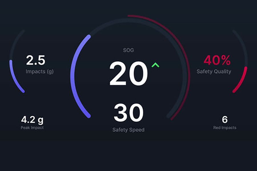
Speed guidance
Using collected and real-time data on vessel motions, weather and sea conditions, engines and systems, and operator and vessel response, the system makes continuous predictions for the trip and decides on the optimal actions, presented to the operator in real time recommended speed.
Depending on the trip mode, this guidance will deliver either the highest attainable safe speed or the highest fuel efficient speed. Developed in collaboration with highly experienced vessel captains, this feature delivers the real time decision that a skilled operator would make.
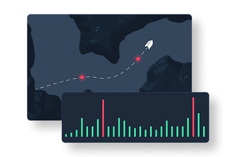
Impact Monitoring
The system's sensor units accurately monitor impactsand vibrations caused as the vessel moves through the water, which are displayed in
real-time to the operator, delivering alerts on board and on shore when
an impact threshold is exceeded. An impact counter records the number
of times the threshold is exceeded.
On board, weather and sea state information from the latest forecast are displayed in real time to the captain.
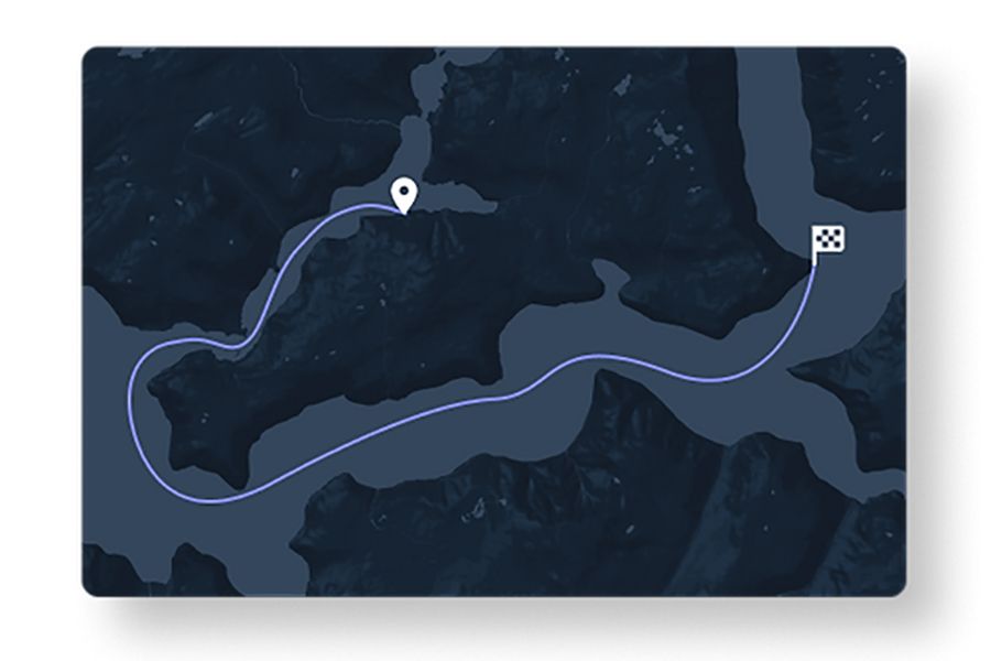
Route guidance (BETA)
Using collected, calculated and forecast data, the weather-adaptive route guidance system finds the optimized route to follow on your journey in order to ensure that the trip is safe and fuel efficient.
Requiring only information on the start and end locations, the chosen vessel, and the starting time, the system will plot a route in only a minute, using the latest weather and sea condition forecast available for the selected region.
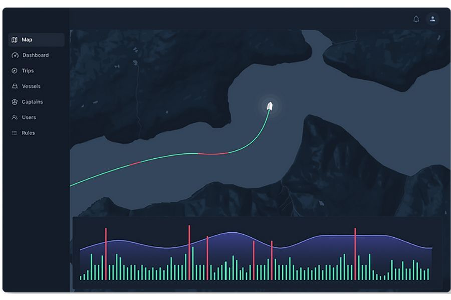
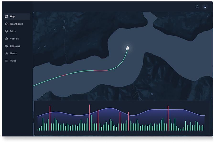
Live vessel monitoring
Monitor vessels in the fleet in real-time, viewing live trips on an interactive map with a graph overlay. View any collected and calculated data, from experienced impacts, safety-optimised speed guidance, fuel consumption, weather and sea conditions, engine performance, and all other available data down to second-by-second resolution.
Monitor status and location of all vessels when operating and when idle, including engine hours, fuel rate, battery voltage, water depth, oil temperatures and pressure.
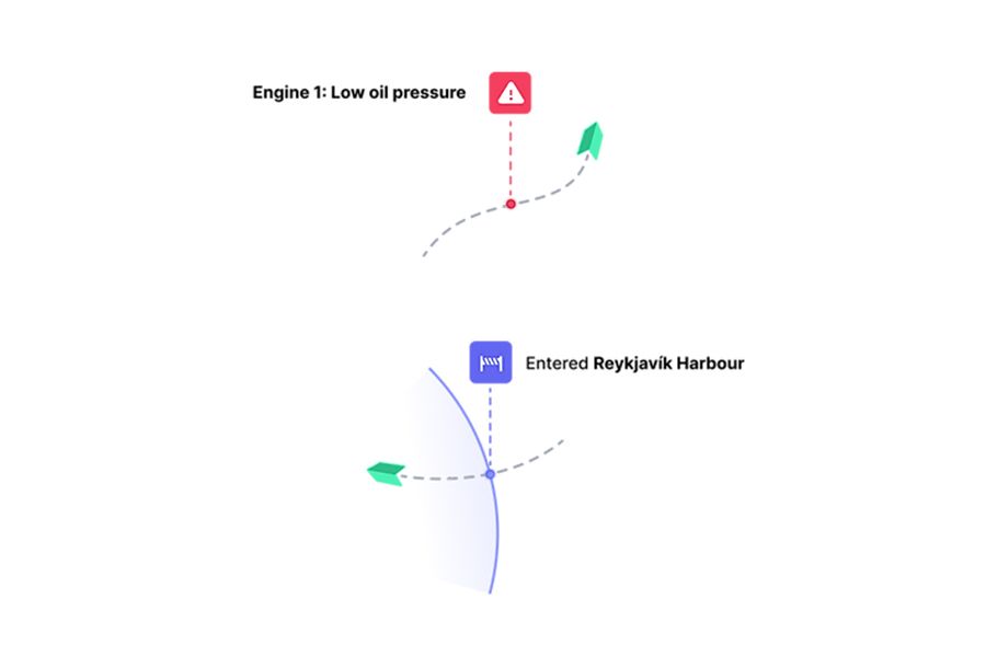
Rules and alerts
Define custom rules for vessels that apply everywhere or within specific geofences that trigger alerts when violated. Custom alert rules can be defined for any data collected, from speed and wave impacts to fuel rate or oil pressure.
Receive real-time alerts from geofences, custom rule violations and vessel warnings from NMEA2000 in the on-shore platform and via email or SMS.
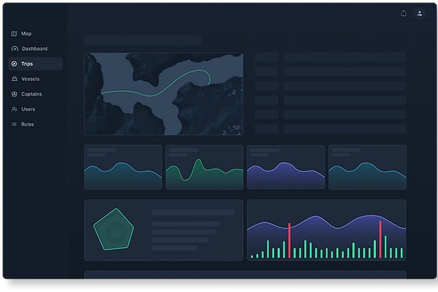
Fleet insights and stats
View detailed statistics for each trip or the entire fleet over selected time periods. Study and compare trips, vessels, captains and aggregate fleet data on highly interactivecharts. Inspect trips on a geographical map with an interactive chart overlay where hovering over a data point shows the exact location of the vessel at that point of time.
Automatically generated reports for each trip with key insights and analysis, alerts, and tracking. Keep track of the entire fleet performance and individual
trips, vessels and captains with radar charts showing an overall score based on analysed data and performance criteria.
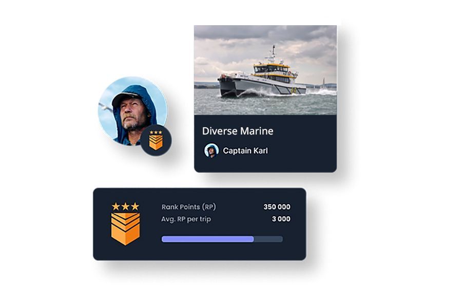
Vessel and Captain profiles
Break down the performance of individual vessels and captains with statistical and analytical profiles.
Watch captains progress in rank from Trainee to Legend as their trip scores improve over time. Give your captains access to their profiles and their performance ranking to enhance engagement and data ownership.